Real elevation
Built from global elevation data, so every ridge and valley sits where it does on the ground.
 Route Studio
 · SatoPrints
Your run, ride or hike becomes a 3D-printed piece of the real terrain, with the route inlaid in its own colour. See it in 3D, then download the print files.
Not sure where to start?
Gift mode is on. Upload or draw the route, and you can add a gift note in the last step.
How it works
Export the activity from Strava, Garmin Connect or your watch app. No file? Trace the route on the map instead.
Pick a size, then a circle, square, rectangle or hexagon. Move it over the map and choose water, roads and buildings.
Turn the finished piece in 3D, add a title, name and run stats, then download the STL or 3MF files.
Printed in two parts
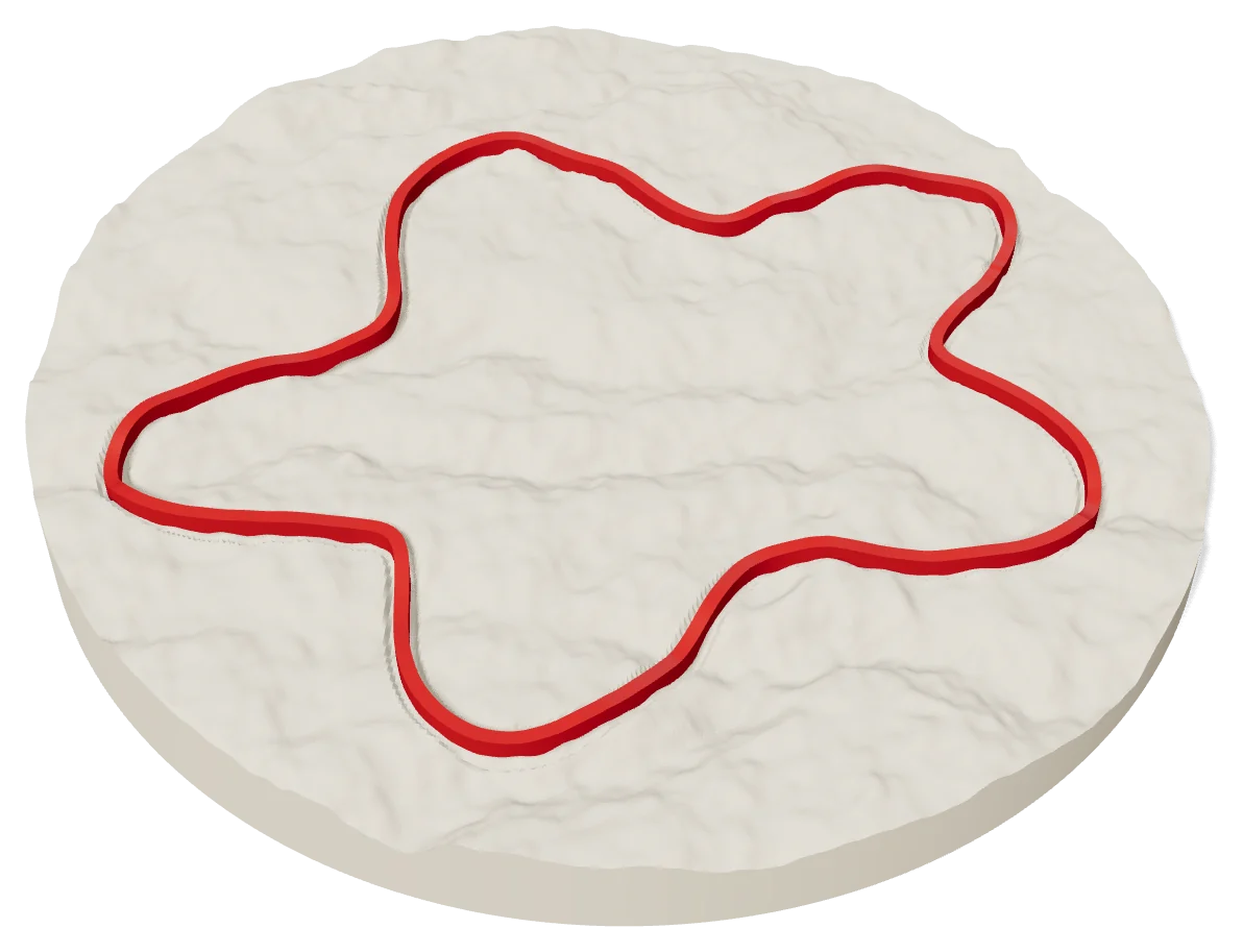
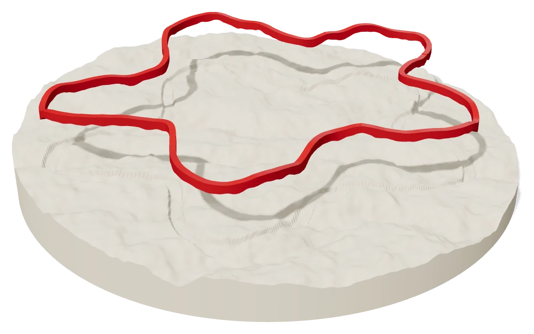
The ground prints as one solid piece with a groove cut along your route. The route prints on its own, already bent to the hills, and drops into that groove.
No GPX needed
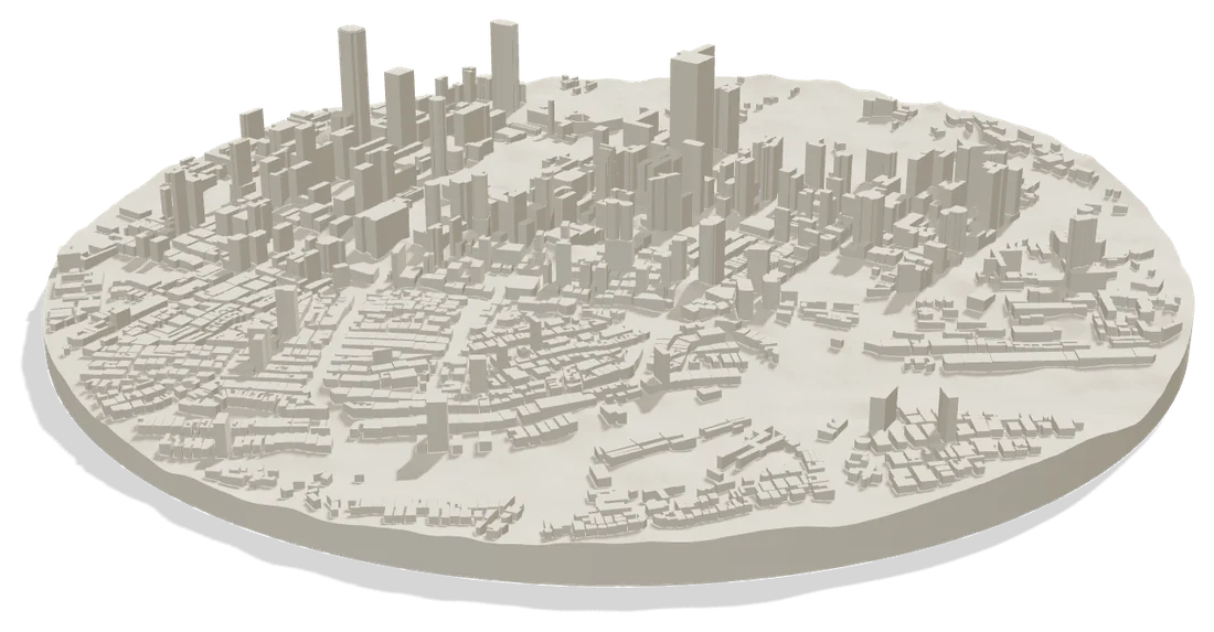
Search a city or neighbourhood. Every building rises to its real height from OpenStreetMap and stands on the real ground under it.
Hiking routes
Each route follows the real trails mapped on OpenStreetMap. Pick one to see it on the terrain in 3D, or search any hike, mountain or forest: we look up every mapped trail, Kenyan ones first, and you can trace the trail yourself if it isn't mapped yet.
Marathons
Each course is traced from the organiser's published course map onto the real streets. Pick one to see the full 42.195 km on the city in 3D, or upload your own watch GPX if your race isn't here yet.
Why it exists
A finish line lasts a second and a screenshot gets buried. The ground you covered should be something you can hold, hang and hand to someone. Route Studio turns it into an object.
What you get
Built from global elevation data, so every ridge and valley sits where it does on the ground.
The track becomes a ribbon shaped to the land. Closed loops stay closed.
Switch each map layer on or off before you generate the model.
Every piece comes framed, in a frame made for its size: 8×10, 8.5×11, 12×16 or 20×20 inches.
Add the race name, your name, date, distance, elevation, time and pace in the font you like.
Download the terrain and route as STL files, or both as one 3MF that opens in Bambu Studio.
GPX help
Open the activity on strava.com in a browser, click the ⋯ menu and choose Export GPX.
Open the activity, click the gear icon and choose Export to GPX.
Use and trace the run on the map. The distance updates as you click.
Drop the GPX or draw the route. You see your piece in about a minute.
Route Studio Use your email. We send a 6-digit code, no password needed. New here? This creates your free account.
Free covers previews and the 8" × 10" piece as an STL. Pro unlocks every size, split tiles and the colour 3MF. Or send the design to us and we print it.
You go to our secure card page (DPO) and come back here when it's done.
We get your design exactly as you see it, check it, and reply with a price. Nothing to pay now.